Handheld GPS
Garmin GPSMAP 65 Review: Multi-Band Precision in a Familiar Handheld
A hands-on look at the Garmin GPSMAP 65, its multi-band GNSS precision, elevation accuracy, battery life, maps, and who should buy it.
Introduction
The Garmin GPSMAP 65 is the latest generation handheld in the GPSMAP line, and it arrives with a genuinely new capability: multi-band satellite reception. The GPSMAP 65s and the similar GPSMAP 66sr, released at the same time, share the same multi-GNSS foundation. The promise is straightforward. More signals, and more types of signals, give the receiver more information to work out where you are.
After five or six weeks of regular trail use, the precision claim holds up. The harder question is whether it changes anything for a typical hiker. This review covers what the new satellite technology does in practice, where the GPSMAP 65 still feels dated, and who should consider it over a cheaper or better-equipped alternative.

Who This Product Is For
The GPSMAP 65 makes the most sense for hikers who want the most precise consumer handheld GPS available, particularly those who spend time in canyons and other places where signals bounce off rock walls. In those environments the receiver can identify a distorted signal and drop it before it skews the position calculation.
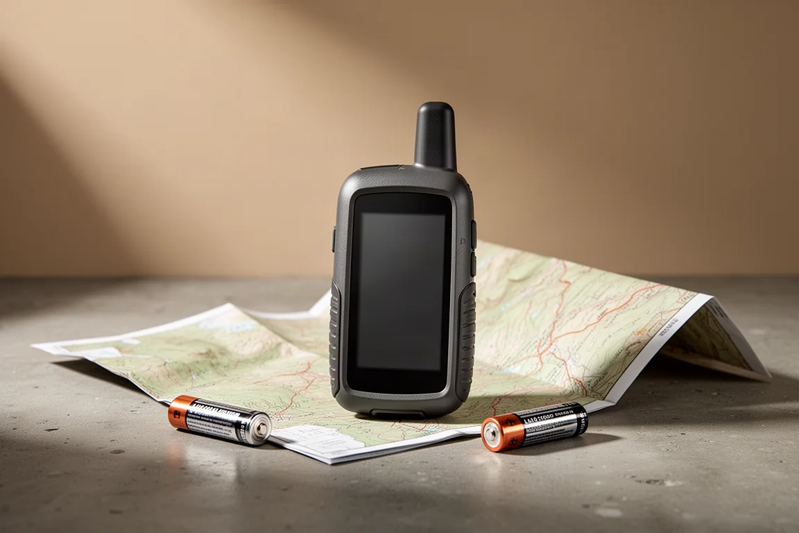
It also suits hikers who like a familiar, button-driven interface and the flexibility of two AA batteries. Alkaline, lithium, and rechargeable cells all work, and rechargeables can be charged inside the device.
It is a weaker fit for anyone whose main concern is backcountry communication. The GPSMAP 66i is larger and lacks multi-band reception, but it includes inReach, which allows text messaging to emergency personnel, friends, and family when there is no cell signal. For most hikers, that matters more than a couple of feet of positioning accuracy.
Positioning Accuracy and Multi-Band GNSS
GNSS stands for global navigation satellite system, and GPS is the United States version of it. The GPSMAP 65 also receives GLONASS and Galileo, plus one additional system each from India and Japan. There is no per-system toggle on this unit: the options are multi-GNSS, GPS only, or demo mode.
Multi-band reception goes a level deeper. Within each satellite system there are several bands, including a public band open to hikers and hunters, a civil band used for non-military applications that need more precision, and encrypted military signals. The United States government states that the public GPS band provides roughly 25 feet of accuracy. The civil L5 bands were later opened to public use, and Galileo and GLONASS have done the same.
The GPSMAP 65 is the first receiver that can pick up both the public and civil bands. That matters because if a signal arrives distorted by the atmosphere, or after bouncing off a canyon wall, the unit can compare it against a second signal from the same satellite on another band and discard the unreliable reading.
In practice, that produced around six feet of positioning accuracy. The GPSMAP 66i and the Montana 750i, which lack this technology, typically managed around eight feet at their best, so the gain is roughly 25 percent. A phone running a mapping app reported about 16 feet in the same conditions.
Elevation improves more noticeably. Older units without multi-band reception were off by 50 to 200 feet in testing, and Garmin describes precision for those older units as within roughly 400 feet. The GPSMAP 65 stayed within 10 to 20 feet. The barometric altimeter can be calibrated manually at a known elevation, or set to auto calibration, which blends the GPS elevation with barometric altitude and map data.

Main Strengths
- Positioning precision that holds up in canyons and mountainous terrain
- Elevation readings within 10 to 20 feet in testing, against 50 to 200 feet on older non-multi-band units
- Familiar hardware: the same case as the GPSMAP 64, with physical zoom, arrow, find, mark, quit, enter, and menu buttons, a lanyard clip, a spine mount, and a rubberized grip that sits well in the hand
- Two AA batteries, with support for alkaline, lithium, and rechargeable cells
- Battery life close to Garmin’s 16-hour rating, with 14 to 16 hours of use recorded when battery saver was enabled, Bluetooth was off, and unused maps were disabled. Lithium cells last longer
- Bundled TopoActive maps with contour lines, trail names, and points of interest, built on OpenStreetMap data, plus a Public Lands layer that shades state and federal land
- About 3.7 GB of free internal memory for extra map sets, including free OpenStreetMap files, custom maps, and scanned topographic maps
- Straightforward routing and waypoints: mark a point with the mark button, review it in the waypoint manager, follow turn-by-turn steps on the active route page, and track progress on the trip computer and compass pages
- Bluetooth for wireless transfer through the Garmin Explore app, a first for this line
Maps, Routing, and Everyday Use
The interface will be instantly familiar to anyone who has used a Garmin handheld. The page button cycles through quick menu items, which can be customized, and the main menu holds everything else. There is no Connect IQ support, so third-party apps are not an option here.
The bundled maps are good enough to hike with out of the box. Contour lines, trail names, and amenities are all present, and the OpenStreetMap base means a large number of documented trails appear. Turning off the maps you are not using helps the screen redraw faster. Garmin’s Bird’s Eye satellite imagery is available but requires a paid subscription and is not included with the device.
The Public Lands layer shades public land as you scroll, which is a useful addition, though it covers state and federal land only. Local and county parks are not included. With about 3.7 GB of free internal memory, there is plenty of room for additional map sets.
Routing works well once you learn the sequence. Place the cursor on a destination, press enter, select the point, and choose go. The device calculates a route and lists the steps, so you can follow each turn as you walk. Waypoints are just as easy: press mark, adjust the details if needed, and save. Stopping navigation is less obvious, since it requires pressing find and then stop navigation. Point-of-interest search covers geographic points and land features alongside the usual categories.

Things to Consider Before Buying
The battery indicator is the most persistent annoyance. It relies on battery voltage rather than a measured percentage, and it shows only a bar icon. Readings can jump from two bars to empty, and low-battery warnings sometimes appear on cells that are still relatively fresh. A firmware update may improve this.
Bluetooth syncing is functional but convoluted. Data must first sync with Garmin Connect and then with Garmin Explore. Collections organized in Explore do not carry through cleanly either, since waypoints from every collection arrive together in the waypoint manager. Transferring files over USB, or using Garmin BaseCamp, is simpler and remains the more reliable route. The device also supports phone notifications over Bluetooth, though many hikers will prefer to leave Bluetooth off to save battery.
The precision advantage is real but situational. Knowing you are within six feet rather than eight feet rarely changes a decision on a marked trail, and a phone with a mapping app may be accurate enough for ordinary day hikes.
Upgrading from an older six-series handheld is also hard to justify unless you specifically want the extra precision or the existing unit is failing.
Buying Advice
If you want the most precise consumer handheld GPS available and you hike in canyons or mountainous terrain where signals bounce and drift, the GPSMAP 65 is a strong choice. It keeps the familiar hardware, the AA battery flexibility, and the preloaded trail maps that make Garmin handhelds easy to live with.
For most hikers, however, the GPSMAP 66i remains the more useful device. It is slightly larger and does not offer multi-band reception, but inReach messaging is a meaningful safety feature in the backcountry, and that advantage shows up far more often than a two-foot difference in positioning.
Choose the GPSMAP 65 if precision and this specific form factor are what you are after. Choose the GPSMAP 66i if you would rather carry satellite communication.

Conclusion
The GPSMAP 65 delivers on its central promise. Multi-band reception gives it a measurable edge in positioning and a much larger edge in elevation accuracy, and it handles canyons and reflected signals better than earlier handhelds.
The catch is that those gains only matter in specific conditions. For trail hiking under clear sky on a well-marked route, the difference between six feet and eight feet is not something most people will notice. The GPSMAP 65 is the most precise handheld Garmin offers, and for the right hiker that is exactly the point.
Product link
View more details for Garmin GPSMAP 65
This product is mentioned in the review. Check the specifications, options, and compatibility before buying.
View more details for Garmin GPSMAP 65Further reading
Related Reviews
Handheld GPS
Garmin eTrex Touch Review: Rugged Handheld GPS With Real Trade-Offs
A detailed look at the Garmin eTrex Touch, covering real battery runtime, GPS accuracy, all-weather touchscreen performance, and the software quirks to weigh before buying.
Handheld GPS
Garmin GPSMAP H1 Review: A Capable Handheld Navigator That Still Needs Polish
A close look at Garmin's flagship handheld navigator: accurate tracks after months of firmware updates, dependable inReach messaging, and the screen and battery trade-offs to weigh before buying.
Handheld GPS
Garmin Montana 750i Review: A Big, Rugged Handheld GPS With Real Trade-Offs
A practical look at the Garmin Montana 750i, covering the large transflective touchscreen, inReach messaging, preloaded maps, the camera, battery behaviour, and the trade-offs worth weighing before buying.