Wearables
Apple Watch Ultra 2 Hiking Features: Maps, Custom Routes, and Satellite Messaging
A practical look at the hiking maps, downloadable routes, custom route creation, workout check-in, and satellite messaging arriving on Apple Watch Ultra 2.
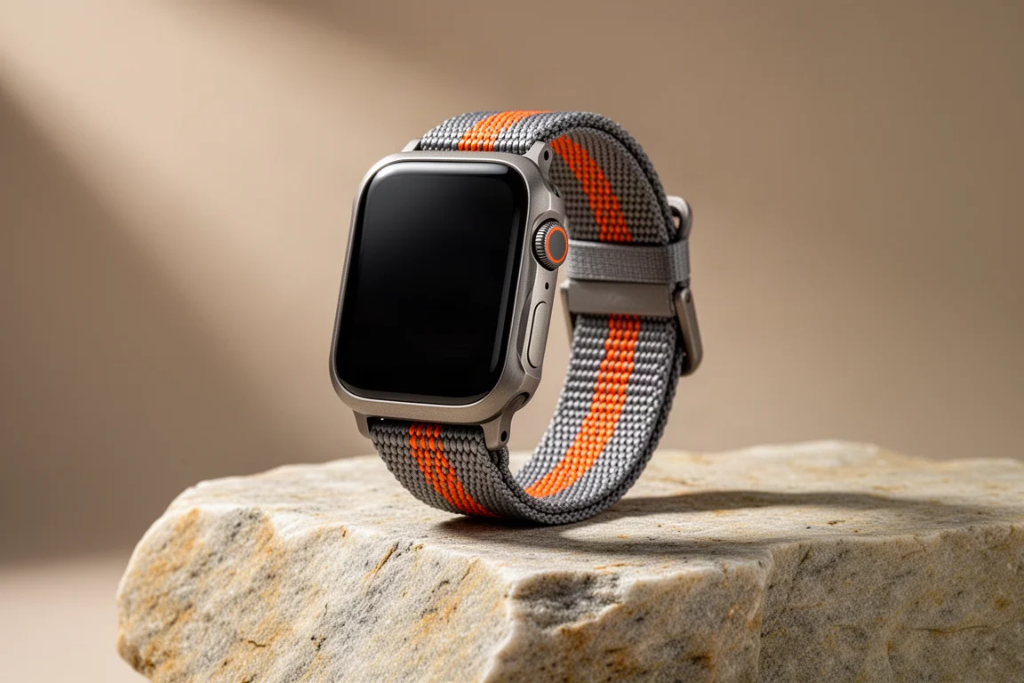
Introduction
Apple has added a set of hiking-focused tools to Maps, bringing trail discovery, downloadable routes, and custom route creation to iPhone and Apple Watch. Alongside them, non-emergency satellite messaging extends text communication to places with no cell coverage. These features were tried ahead of their wider release, on an iPhone 15 paired with an Apple Watch Ultra 2, at Joshua Tree National Park in roughly 110 degrees Fahrenheit heat. That combination of a demanding environment and early software makes the strengths and the rough edges easy to see.
Who This Watch Is For
The hiking additions are aimed at people who already carry an iPhone and wear an Apple Watch, and who want route planning, on-trail guidance, and a basic safety net in one place. That includes casual walkers who simply want a mapped trail with a distance and a time estimate, and more ambitious hikers who plan longer routes and want directions to a trailhead without juggling several apps. The satellite messaging side speaks to anyone who heads beyond cell coverage and wants a way to send a message or share a location without carrying a separate satellite communicator.

It is worth being clear about the audience. These tools are not a replacement for specialist navigation apps, and they are not positioned as a full backcountry navigation suite. They are an extension of Maps, built to feel familiar to anyone who already uses Apple Maps for driving and walking directions.
Main Strengths: Planning and Downloading Hikes
Planning starts inside the Maps app. Searching for a park returns an official entry, and a tray at the bottom of the screen lists popular hikes sorted by distance, with more trails available behind a further option that opens a map view of every listed route. Selecting a hike shows an elevation profile, a distance, and a time estimate. The catalogue is broader than a short list of easy walks: it reaches up to a 42-mile route better suited to a backpacking trip, and it includes lesser-known trails alongside the obvious ones.
Saving a hike is straightforward. Adding it to the library opens a screen where a route can be renamed, annotated with notes, and downloaded for offline use, and a notification confirms when it is ready. From the same screen, directions can be requested to the trailhead, which then behaves like any other destination, including appearing on CarPlay. Saved routes live in a library section, where they can be reviewed or deleted.
Main Strengths: Creating Custom Routes
Not every walk follows a published trail, and custom route creation covers that gap. Marking a location and choosing to create a custom route opens a simple point-and-tap tool: each tap snaps to the trail network, and points can be deleted or adjusted. Standard editing options are included, such as reversing the route, converting it to an out-and-back, or closing it into a loop. Once saved and named, a custom route behaves just like any saved hike.

The underlying map data comes from OpenStreetMap, with the trail network vetted by the parks involved and the Apple Maps team. In everyday use, that means route creation feels close to the tools found in dedicated training and trail platforms, while staying inside the same app used for the drive to the trailhead.
Main Strengths: Turn-by-Turn Guidance on the Trail
Starting a route gives a brief safety reminder about watching your footing, then presents trail directions in the same visual language as walking directions elsewhere in Maps, mirrored on the Apple Watch. There is a scrollable turn-by-turn list, an elevation plot that shows your position along the route, and the option to change map orientation.
On a twisting trail, the guidance has limits. There are no arrows on the path, and at a fork on a loop there was no indication of which way to turn. Going off route produced no alert, and neither did heading the wrong way. Turn notifications do appear in the Workouts app, but Maps is not available as a data screen inside a workout, so tracking a hike means starting it in Workouts and switching back to Maps for directions. Near the end of the loop a turn notification did arrive to make the exit, followed by an arrival notification, which suggests the notification logic simply needs more tuning for winding trails.
Main Strengths: Workout Check-In and Satellite Messaging
The Workouts app gains a check-in option on the pause screen. Activating it sends a message to an emergency contact, who can follow the workout and receive a notification when it finishes. In practice it required an internet connection and did not work over satellite, which is the one gap that would matter most on a remote hike.
Satellite messaging is the more ambitious piece. In an area with no cell service, the phone offers to switch to satellite, then guides you to find a clear view of the sky and point the device at the satellite, showing a map of your position and a list of the services available over the connection. The connection is initiated manually rather than running continuously, a sensible choice for battery life, and the interface turns green once the link is established. A standard SMS message went out with a timestamp, though a recipient running older software could not reply, and replies only arrived once cell coverage returned. Find My over satellite uses an older dialog style but worked as expected.

The intended behaviour is reasonable: SMS recipients can reply after you initiate contact, while iMessage users can send to you directly and messages are checked when a connection is available, which may require a manual check. This is early software, and the experience should tighten up as the wider release arrives.
Things to Consider Before Buying
Offline reliability is the main caveat. Saved routes did not appear on the watch when it was placed in airplane mode at the trailhead, and while routes did sync to the watch after a hike, opening an offline map later stalled on a loading screen for around seven minutes. Both behaviours are consistent with pre-release software and are likely to be addressed, but they are worth knowing before relying on the watch alone for navigation.
There are also structural limits. Check-in needs connectivity, satellite messaging needs a clear view of the sky and a manually initiated connection, and the trail guidance is thinner than what specialist hiking apps provide. If route data depth is your priority, those apps still have a role to play.
Buying Advice
The Apple Watch Ultra 2 makes the most sense for hikers who already live in the Apple ecosystem and want trail planning, directions, and satellite messaging without adding another device to their kit. The convenience of planning a hike in Maps, getting directions to the trailhead, and having the route appear on the wrist is genuinely useful, and satellite messaging is a meaningful safety addition for trips beyond coverage.

If you mostly walk well-marked local trails, the built-in features are likely enough on their own. If you regularly navigate complex backcountry routes, treat these tools as a helpful layer rather than your only navigation source, at least until the software matures.
Conclusion
Apple’s hiking features bring genuine value: a large trail catalogue with elevation and distance data, downloadable routes, flexible custom route creation, and satellite messaging for areas without service. The current rough edges, from sparse turn-by-turn cues to offline sync quirks, look like early-software problems rather than design dead ends. For Apple Watch Ultra 2 owners who hike, they are a useful addition to an already capable watch.
Product link
View more details for Apple Watch Ultra 2
This product is mentioned in the review. Check the specifications, options, and compatibility before buying.
View more details for Apple Watch Ultra 2Further reading
Related Reviews
Wearables
Apple Watch Ultra 3 vs Garmin: Which Training Watch Wins for Athletes
A practical head-to-head comparison of the Apple Watch Ultra 3 and Garmin for serious training, covering GPS accuracy, data tracking, usability, and recovery metrics.
Wearables
Apple Watch vs Garmin for Running: A Year of Training Compared
After a year training for marathons with both devices, here's what actually matters when choosing a running watch.
Wearables
Apple Watch Ultra 3 vs Garmin Fenix 8 Pro: Satellite Messaging Compared
A practical comparison of satellite messaging on the Apple Watch Ultra 3 and the Garmin Fenix 8 Pro, covering connection methods, messaging workflows, coverage, and running costs.