Polski · Handheld GPS
Garmin GPSMAP 66sr Review: Multi-Band Accuracy for Demanding Terrain
A field-focused look at the Garmin GPSMAP 66sr, covering multi-GNSS and multi-band accuracy, battery life, mapping, and the trade-offs worth knowing before you buy.
Introduction
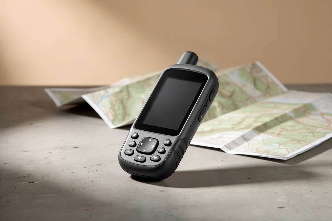
The Garmin GPSMAP 66sr is the model Garmin places at the top of its handheld range for positioning accuracy, and the specification sheet explains why. It pairs multi-GNSS reception with multi-band signal support, a combination that is uncommon among consumer handhelds, and wraps it in a rugged, button-driven body with a sunlight-readable display, preloaded topographic mapping and a battery rated for multi-day trips.
Field use across the Grand Canyon rim-to-rim-to-rim route and trails in Southern California and Arizona showed the 66sr holding its track line through steep canyon walls where several companion devices drifted well off the path. It is not flawless, and a few rough edges are worth understanding before you commit. What follows is how it performs, what it does well, and where it makes sense.
Who This Handheld Is For
This is a device for people who navigate away from reliable phone signal and away from fair weather. Hikers, backpackers, geocachers, hunters and outdoor volunteers are the natural audience, because the 66sr is designed to be operated with gloves, in rain and in the cold. Buttons with haptic feedback and an audible click make it usable when a touchscreen would be awkward, and the rubberized body gives you something to grip when your hands are wet or numb.
It also suits anyone who wants a dedicated navigation device rather than leaning on a phone, since a phone in the backcountry has to share its battery with the camera, the headlamp and everything else.

If you hike only in good weather on well-marked trails close to home, a phone app will usually cover you. The 66sr earns its place when accuracy, weather resistance and battery endurance matter more than convenience. It is worth noting up front that the 66sr does not include satellite messaging, a capability that lives on the GPSMAP 66i instead.
Positioning Accuracy: Multi-GNSS and Multi-Band
Two features define the 66sr’s positioning performance. The first is multi-GNSS. A conventional GPS unit listens only to the United States constellation, while a multi-GNSS receiver also pulls signals from Galileo in Europe, GLONASS in Russia, and the Indian and Japanese systems with coverage over Asia. The 66sr does not receive the Chinese constellation, which in practice makes little difference given that more than 100 satellites are operational across the systems it does support. More satellites means more options. A receiver needs four signals for a three-dimensional fix and three for a two-dimensional one, and extra signals let it favour a clean source over a weak or obstructed one.
The second feature is multi-band reception. Early GPS satellites transmitted a single signal, known as L1, which is broadly comparable to AM radio. It works, but it is prone to interference. Newer signals, including L5, behave more like FM radio, carrying data a receiver can read more reliably. The 66sr receives both bands, and when it picks up L1 and L5 from the same satellite it can compare them, identify errors and discard the corrupted reading. That matters most in the situations that break ordinary receivers, such as multipath, where a signal bounces off a canyon wall or a tall building before reaching the antenna, and atmospheric disturbance that distorts the signal on the way down.
The practical result is accuracy of around six feet, reported consistently whether the unit is in open ground or deep in the Grand Canyon. Think of that figure as the radius of a bubble the receiver says you are probably inside. For hiking, backpacking, geocaching and hunting, six feet is comfortably good enough, and a smaller bubble would rarely change a decision on the trail.
Track Accuracy in Challenging Terrain
A single accuracy figure matters less than consistency while you are moving, because every position feeds the track you record. On a rim-to-rim-to-rim crossing of the Grand Canyon, the 66sr was compared against three other devices, a GPSMAP 66i, a Fenix 6X Pro Solar and an iPhone 12 Pro Max.
In open desert under a clear sky, all four produced nearly identical lines. The differences appeared in the steep sections. There, the companion devices drifted away from the trail, in some places by a wide margin, while the 66sr stayed on the path. The pattern repeated on the return leg under different atmospheric conditions, although the 66i performed noticeably better on the second day than the first, a reminder that conditions and timing influence every receiver. The 66sr was not flawless either. It drifted in a couple of places, and there was one stretch where none of the devices placed the track correctly.
The consequence of drift is measurable. When a receiver jumps from side to side, it adds distance to the recorded track, and on this route some tracks picked up roughly a mile of extra distance. The 66sr’s steadier line produced a distance closer to the real one.
Elevation is handled well too. GPS-derived elevation stayed within about 10 feet, and the barometric altimeter is calibrated from that GPS elevation, so altitude readings benefit from the same accuracy. If you would rather not use that calibration, it can be turned off or combined with map data instead.
Battery Life and Charging
Garmin rates the 66sr at 36 hours of runtime, and real-world use lands close to that: around 32 hours with battery saver enabled and the backlight at full brightness. That is enough to cover several day hikes without charging, or a three to four night backpacking trip. Battery saver turns the screen off once the backlight interval expires, which can be set anywhere from 15 seconds to never.
The battery itself is an internal lithium-ion cell, so it cannot be swapped in the field. That will bother some users, and Garmin offers the GPSMAP 65s for anyone who wants similar multi-GNSS and multi-band reception with AA batteries instead. For many hikers the sealed battery is the simpler arrangement. The 66sr charges over micro-USB, the same cable used by a phone, a camera and a headlamp, so a single inexpensive USB power brick and one cable can keep an entire kit running.

One quirk to plan around is the battery indicator, which shows a graphical bar rather than a percentage. A percentage appears only while the unit is charging and powered down. Third-party widgets from the Connect IQ store can add a battery level readout and an estimate of remaining runtime, which is a worthwhile addition for multi-day trips.
Maps and Mapping Options
Preloaded TopoActive maps are included, with the version depending on region. They are built on OpenStreetMap data and updated regularly, and trail coverage is strong. Documented, named trails generally appear with their names, which held true on routes in Southern California and Arizona. Smaller social trails, cutoffs and animal paths are deliberately left out, which keeps the map honest rather than cluttered.
BirdsEye Satellite Imagery comes with a free lifetime subscription tied to the device. The imagery overlays trail names and features, is detailed enough to help with decisions in the field, and is updated periodically. Downloading imagery directly on the unit means selecting a radius over Wi-Fi, while downloading through Garmin Basecamp on a computer is faster and allows custom shapes before transferring to the device.
Storage is expandable with a micro SD card up to 32 GB. Optional Garmin 24K topographic maps and City Navigator maps can be added, the latter enabling address search, which the preloaded maps do not support. Free OpenStreetMap maps can also be loaded, which is useful if you buy a unit with regional maps and then travel elsewhere.
Build, Controls, and Interface
The 66sr is built for rough handling. The body is rubberized, the ports are covered, and the controls are physical buttons rather than a touchscreen. Each press delivers haptic feedback and an audible click, so the unit remains usable in heavy rain or with gloves on. The three-inch display is easy to read in sunlight and the backlight is adjustable. Everything fits in the palm and can be operated one-handed, with the thumb on the front buttons and a finger reaching the power key on top.
Navigation on the map is done with arrow keys, and almost everything on the device can be customized. Different profiles can be configured for different activities, home screen icons and settings can be added or removed, and data fields on each page can be changed so only the numbers you care about are visible.
Connectivity covers Wi-Fi and Bluetooth, with syncing to the Garmin Explore app for outdoor navigation and to Garmin Connect for fitness data, or both at once. Connected by cable, the unit mounts as a disk drive, so GPX tracks can be copied off directly, and Garmin Basecamp can be used for trip planning with the same maps at higher resolution.

The compass is accurate, and the altimeter is occasionally off on its own but reliable once calibrated from GPS elevation, one of the quieter benefits of the 66sr’s positioning performance.
The interface itself is the most dated part of the package. It looks old-fashioned and is due for a refresh, and anyone coming from a modern phone app will notice immediately. The counterargument is that it is simple, predictable and consistent, with no small text to squint at, which is exactly what you want when the weather turns and your eyes are tired.
Things to Consider Before Buying
Active Weather is the clearest limitation. It needs an internet connection through a paired phone or Wi-Fi, so it is not a backcountry forecasting tool, and even when it works the forecast is no better than what a phone provides, often with coarser resolution.
The lack of satellite messaging is the second. If you want inReach capability in the same device, the GPSMAP 66i is the model to look at, but it does not offer multi-GNSS or multi-band reception, so those two capabilities are effectively mutually exclusive within this family.
The sealed battery is a third consideration, and screen protection is a minor one. The display can crack if the unit is clipped to a pack that gets thrown down, so a screen protector or a padded pocket is sensible.
Buying Advice
The right choice depends on which capability you cannot do without. If positioning accuracy in difficult terrain is the priority and you also want satellite messaging, pairing the 66sr with a compact inReach device covers both needs without compromise.
If the difference between six feet and roughly twelve feet of accuracy would not change how you navigate, the GPSMAP 66i remains a sensible option for most people, with the caveat that extreme environments such as the bottom of the Grand Canyon are where the gap shows up. If replaceable AA batteries matter more than anything else, the GPSMAP 65s delivers comparable multi-GNSS and multi-band reception in a battery-swappable design.
For the majority of backcountry users, the 66sr’s accuracy is about as good as it needs to be. What separates it is not the headline number but how steadily it holds that number while you move, which is what turns a recorded track into something you can rely on.
Conclusion
The Garmin GPSMAP 66sr earns its position at the top of Garmin’s handheld range for accuracy. Multi-GNSS and multi-band reception produce roughly six feet of accuracy in open ground and in steep canyons, elevation stays within about 10 feet, and the recorded track held the trail where other devices drifted during a demanding Grand Canyon crossing. Battery life of around 32 hours, preloaded TopoActive maps, BirdsEye imagery and a rugged button-driven design round out a device built for serious outdoor use.
Its weaknesses are real but narrow. Weather forecasting needs a connection, satellite messaging is not included, the battery is not user-replaceable, and the interface feels dated. Buyers who need those specific capabilities have clear alternatives in the same family. For hikers and backpackers who value dependable positioning above all else, the 66sr is a strong and well-considered choice.
Link do produktu
Zobacz więcej szczegółów: Garmin GPSMAP 66sr
Ten produkt jest wymieniony w tej recenzji. Przed zakupem sprawdź specyfikację, dostępne warianty i kompatybilność.
Zobacz więcej szczegółów: Garmin GPSMAP 66srWięcej do przeczytania
Powiązane recenzje
Handheld GPS
Garmin eTrex Touch Recenzja: Wytrzymałe urządzenie ręczne, które rzadko zastępuje telefon
Wielomiesięczne spojrzenie na Garmin eTrex Touch: niezawodne dotykowe wprowadzanie w deszczową pogodę, wstępnie załadowane mapy topo i długi czas pracy w trybie smart, z drugiej strony drenaż baterii w multi-band i płytki interfejs.
Handheld GPS
Garmin GPSMAP 65 Review: Multi-Band Precision in a Familiar Handheld
A hands-on look at the Garmin GPSMAP 65, its multi-band GNSS precision, elevation accuracy, battery life, maps, and who should buy it.
Handheld GPS
Garmin GPSMAP 65 vs GPSMAP 66i vs Montana 750i: Który ręczny GPS pasuje do Twojej wędrówki
Praktyczne porównanie trzech ręcznych urządzeń Garmin, obejmujące precyzję wielopasmowego GNSS, mapy TopoActive, czas pracy na baterii i komunikację satelitarną.