Marine Navigation
Best Android Chartplotter Apps 2026: Navionics vs OpenCPN vs Orca
A detailed comparison of three leading marine navigation apps that can turn any tablet or smartphone into a capable chartplotter, saving hundreds of euros over dedicated hardware.
Why Android Chartplotter Apps Matter
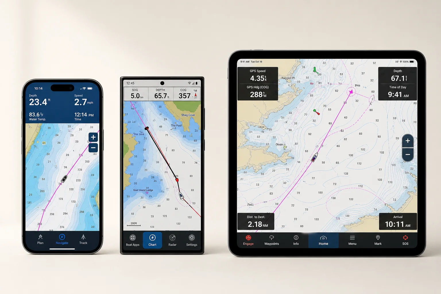
Marine chartplotters have traditionally been expensive, specialized devices costing 700 to 900 euros or more. However, the evolution of smartphones and tablets has fundamentally changed this landscape. Modern Android devices now offer the processing power, GPS accuracy, and bright screens needed to run sophisticated navigation software that rivals or exceeds dedicated hardware from major brands.
The shift began when developers realized that affordable, powerful mobile devices could replace expensive, closed chartplotters that become obsolete within a few years. Today, three applications stand out as the most capable options for turning any tablet or smartphone into a functional marine navigation system: Navionics (now part of Garmin), OpenCPN, and Orca.

Each app represents a different philosophy and approach to marine navigation, with distinct strengths in charting, connectivity, performance, and cost. Understanding the differences between them is essential for choosing the right tool for your boating needs.
Navionics: The Established Standard
Navionics has dominated marine charting for over 50 years, beginning in 1984 in Biaregio, Italy, when Giuseppe Carnevalli and Fosco Biancelli created the world’s first electronic chart plotter. For decades, Navionics was the charting provider for major hardware brands like Raymarine and Lowrance.
The company democratized marine navigation when it released its first Android app in 2010, making professional-grade charting accessible to anyone with a smartphone. Initially, regional charts cost under 25 euros with virtually unlimited use. However, the acquisition by Garmin in 2017 marked a significant shift toward a subscription-based model.
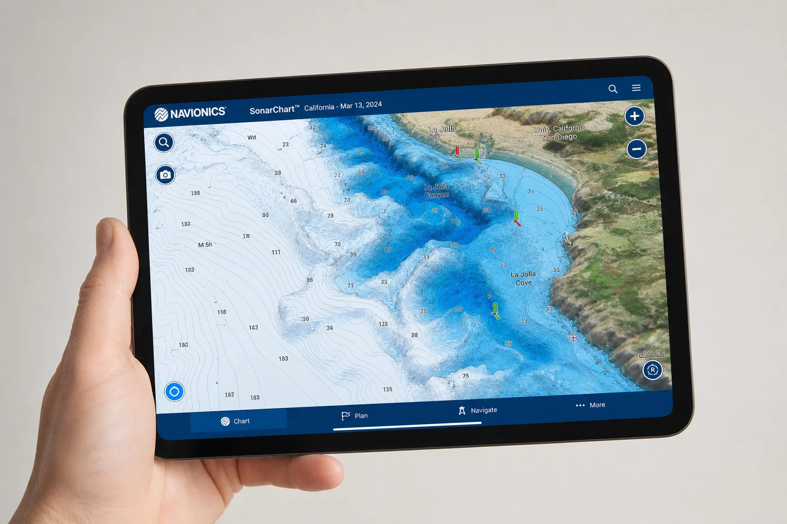
Today, Navionics requires an annual subscription of 50 to 70 euros per navigation area. The app offers several display modes, with SonarChart providing enhanced bathymetry based on data contributed by users worldwide. This user-generated bathymetry is Navionics’ most distinctive advantage: the depth contours and underwater detail are noticeably more accurate than competitors, making it especially valuable for finding good anchorages or avoiding shallow water at low tide.
OpenCPN: The Open-Source Alternative
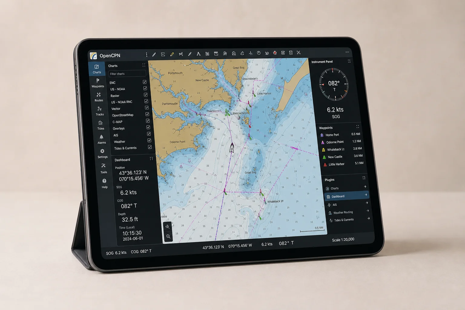
OpenCPN emerged around 2008 as an open-source project founded by Dave Register. Unlike Navionics, which is a commercial product, OpenCPN is built on free software principles and has grown through contributions from developers worldwide. The project supports a plugin system that has expanded its capabilities far beyond basic charting.
The Android version launched in 2015, and the project continues to evolve with professional chart support through the Ocharts portal. OpenCPN can integrate data from virtually any source: network connections, serial ports, USB, or the internet. This open architecture makes it exceptionally flexible for integrating existing onboard electronics, regardless of age or manufacturer.
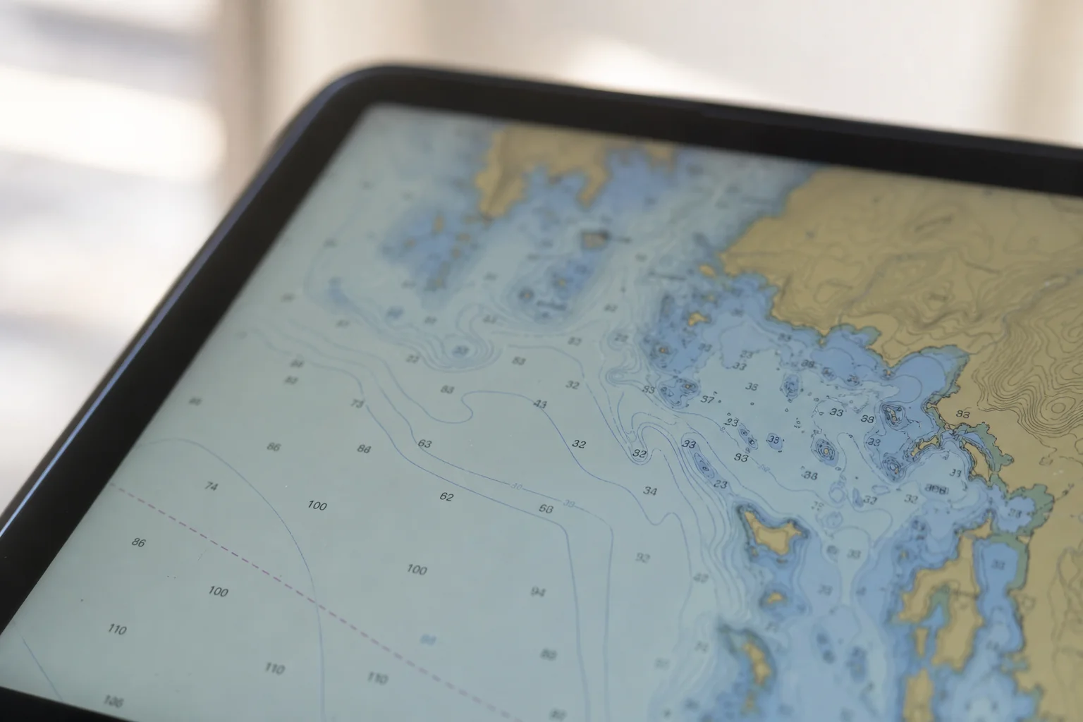
OpenCPN’s strength lies in its extensibility and cost. The Android app costs around 10 euros with no recurring subscriptions, and lifetime updates are included. Charts from Ocharts cost approximately 25 euros per area with a permanent license that works on multiple devices. After the first year of updates, charts continue working indefinitely even without paying for updates.
However, OpenCPN’s interface can feel less polished than commercial alternatives, and route planning is more basic—it draws straight lines between waypoints rather than automatically avoiding obstacles. For offshore navigation, the Weather Routing plugin offers powerful optimization based on forecast conditions and historical data, making it especially useful for longer ocean passages.
Orca: The Modern Cloud-Native Approach
Orca entered the market in February 2021 from Norway with a fundamentally different philosophy. Rather than adapting existing software to mobile devices, Orca was built from the ground up for smartphones and cloud connectivity. The app is available for both Android and iOS and features a modern, intuitive interface strongly resembling Google Maps.
Orca’s core strength is its seamless integration of cloud-based features. The app is free as long as your device has internet connectivity, including worldwide access to basic charting. If you want to download charts for offline navigation, an annual subscription costs 49 euros and covers the entire planet—not divided into regional zones like competitors. Downloaded maps remain on your device even after the subscription ends, though you lose updates and advanced features.
The Orca Core is a dedicated hardware device (approximately 500 euros) that acts as the boat’s brain, integrating high-precision GPS, a 9-axis accelerometer, and NMEA 2000 connections. This allows seamless data sharing with the Orca app over Wi-Fi or cloud connection, enabling you to view vessel data from anywhere. The Orca Display is a rugged 10-inch tablet (around 1,000 euros) with 1,000 nits brightness for sunlight visibility and wireless charging, effectively creating a traditional chartplotter with modern flexibility.
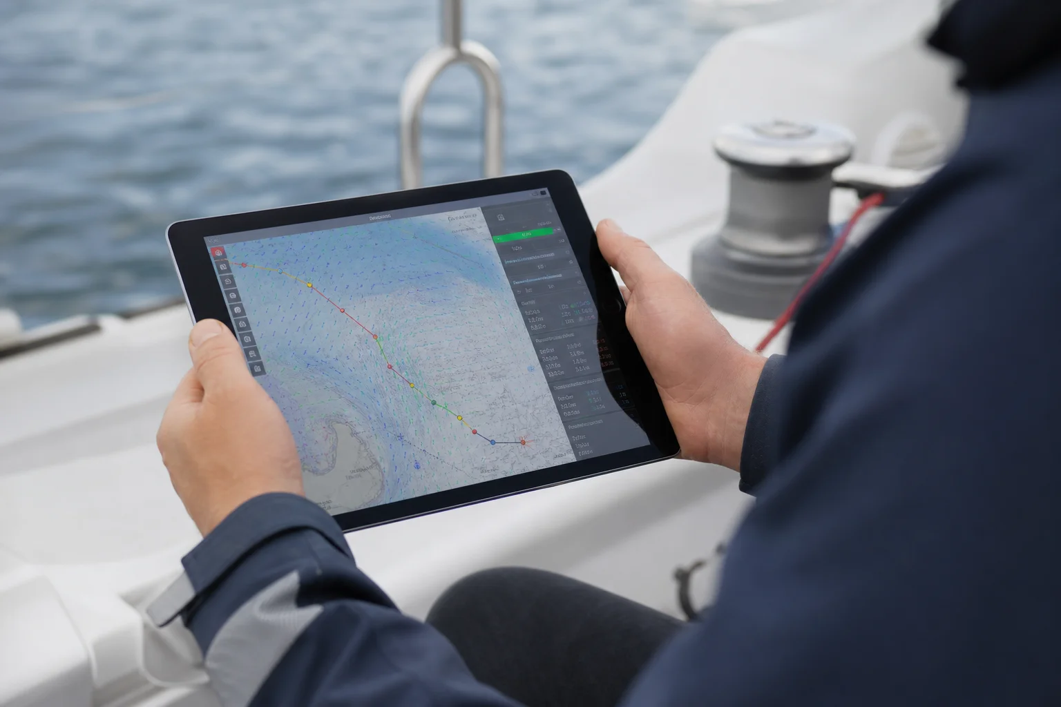
Orca excels at route planning and weather integration. The app automatically calculates optimal routes based on current conditions and forecasts, including tack calculations if you enter your vessel’s wind polars. Instrument dashboards display wind, depth, and other data in highly visual, configurable layouts. However, Orca’s data integration is somewhat closed: advanced features require the Orca Core, limiting compatibility with older or mixed-brand electronics.
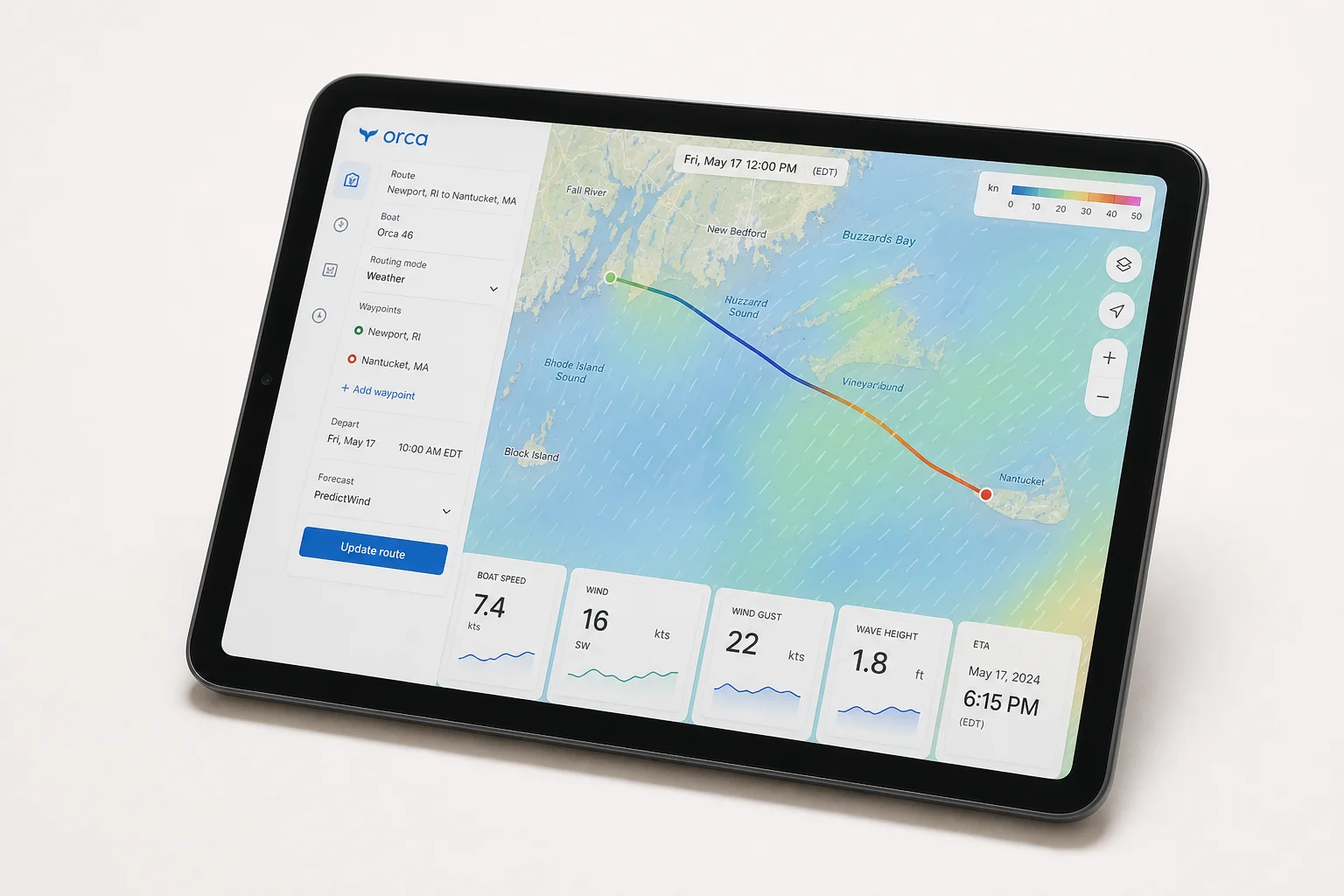
Chart Accuracy and Detail
All three apps base their charts on official hydrographic service data, but they differ in processing and enhancement. Ocharts (used by OpenCPN) takes official information, consolidates it, and provides weekly or monthly updates. Orca applies additional post-processing to make charts more visually streamlined while maintaining the same underlying accuracy.
Navionics stands apart through its proprietary bathymetry enhancement. The SonarChart feature incorporates depth data collected from thousands of users worldwide, resulting in noticeably higher detail and accuracy. Testing in Santander confirmed that Navionics’ bathymetry matches reality more closely than competitors, particularly valuable for detailed anchorage planning and shallow-water navigation.
Performance and Responsiveness
Performance differences between the three apps have narrowed significantly with modern Android devices. Orca is generally the fastest, followed by Navionics, with OpenCPN slightly slower during startup and chart loading. On current hardware, these differences are unlikely to be noticeable or decisive for most users.
Integration and Connectivity
All three apps can receive AIS data over Wi-Fi to display nearby vessels. Orca uniquely obtains AIS information directly from the internet without requiring an onboard receiver, though it will prefer local receiver data if available.
Depth integration is supported by all three, with Navionics using this data to update SonarChart Live in real time. However, Navionics’ integration ends there—it cannot display other instrument data from the boat’s electronics.
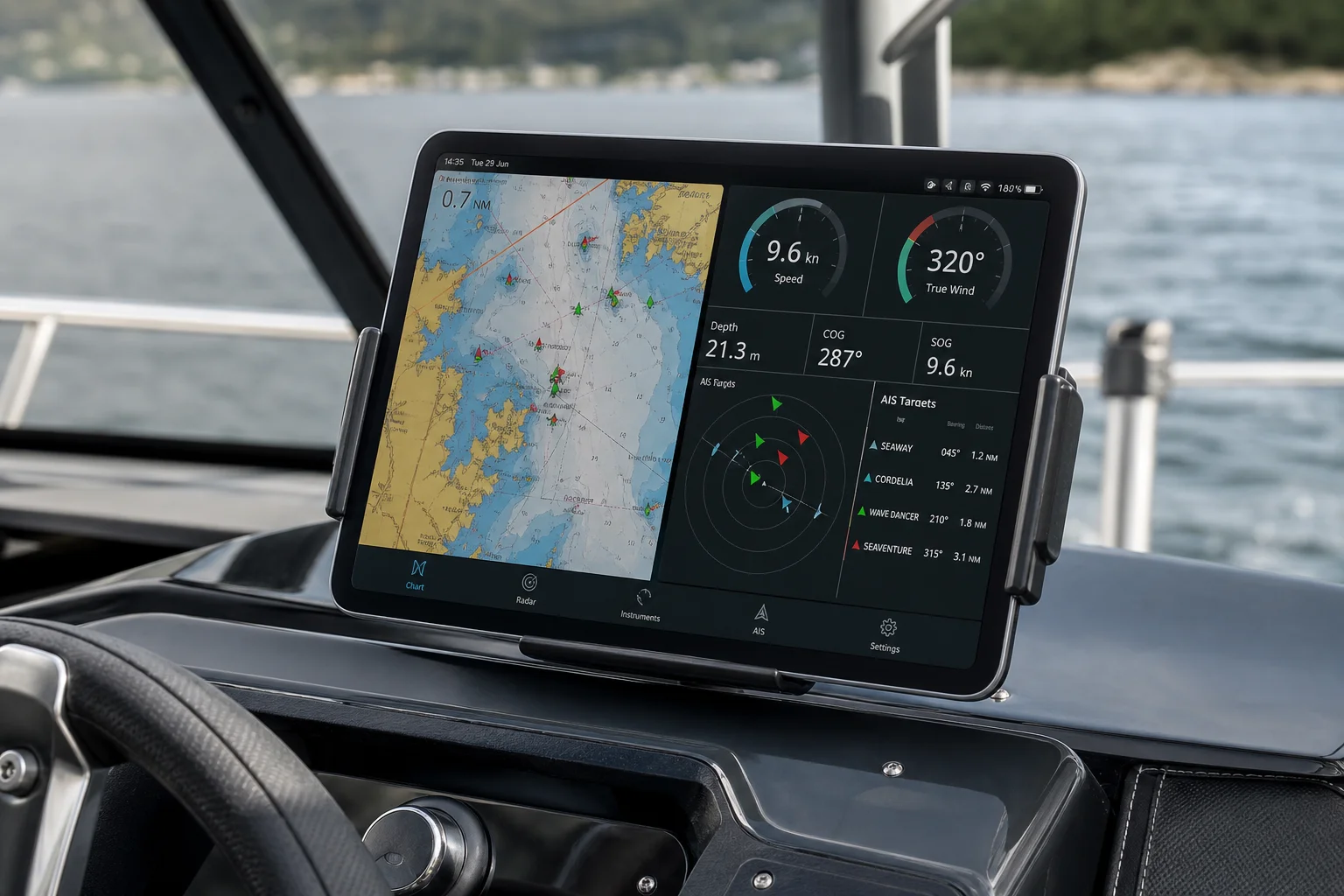
Orca integrates instrument data through highly visual dashboards showing wind, depth, and other configurable parameters, but only through the Orca Core hardware. OpenCPN offers the most flexible integration through its plugin ecosystem, connecting to virtually any data source and displaying information exactly as you configure it. For boaters with diverse or older electronics, OpenCPN’s open architecture is a significant advantage.
Route Planning and Weather
Both Navionics and Orca offer automatic route calculation with obstacle and shallow-water avoidance based on your vessel’s specifications. OpenCPN draws straight lines between waypoints but includes a powerful Weather Routing plugin for offshore passages that optimizes routes based on forecast conditions and historical data.
Orca’s built-in weather routing is particularly strong for coastal and racing applications, automatically calculating optimal tacks and suggesting the best tacking points when you enter your vessel’s wind polars.
Cost Comparison
OpenCPN offers the lowest entry cost: the Android app costs around 10 euros with no subscriptions, and Ocharts charts cost approximately 25 euros per area with permanent licenses and one year of updates included.
Navionics requires an annual subscription of 50 to 70 euros per navigation area. The app itself is free, but advanced features and chart access depend on an active subscription. Without it, AIS display, automatic routing, and chart access become unavailable.
Orca is free with internet connectivity and includes worldwide basic charting. The 49-euro annual subscription enables offline chart downloads for the entire planet, making it especially appealing for long-distance cruisers crossing multiple regions. The Orca Core (500 euros) and Orca Display (1,000 euros) are optional hardware additions.
Conclusion
OpenCPN and Orca emerge as the strongest choices, each excelling in different scenarios. OpenCPN suits sailors who enjoy tinkering and want maximum flexibility with existing electronics, combined with affordable charting from reliable official sources. Orca is ideal for those seeking a polished, intuitive interface with powerful weather routing and instrument integration, particularly appealing for budget-conscious coastal cruisers and long-distance sailors navigating multiple zones under a single subscription.
Navionics remains the leader in bathymetry detail and accuracy, but its rising subscription costs and increasingly closed ecosystem make it less compelling than before. The real advantage of these Android apps is the freedom to choose based on your priorities—and the ability to save hundreds of euros compared to dedicated hardware chartplotters.